
Lake Waihola topographic map
Interactive map
Click on the map to display elevation.
About this map
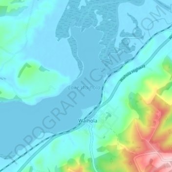
Name: Lake Waihola topographic map, elevation, terrain.
Average elevation: 39 m
Minimum elevation: -6 m
Maximum elevation: 280 m
Other topographic maps
Click on a map to view its topography, its elevation and its terrain.
Lake Waipori
Lake Waipori, Berwick Road, Waihola, Clutha District, Otago, New Zealand
Average elevation: 3 m