
Oita Prefecture topographic map
Interactive map
Click on the map to display elevation.
About this map
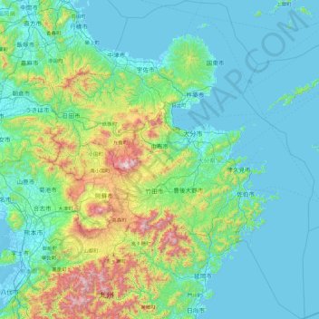
Name: Oita Prefecture topographic map, elevation, terrain.
Location: Oita Prefecture, Japan (32.37889 130.82475 33.84561 132.27609)
Average elevation: 242 m
Minimum elevation: -5 m
Maximum elevation: 1,753 m