
Jeju Island topographic map
Interactive map
Click on the map to display elevation.
About this map
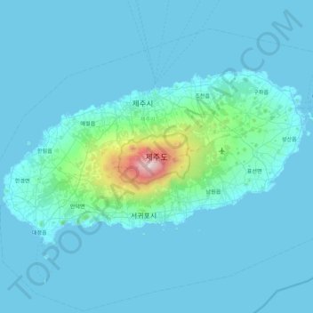
Name: Jeju Island topographic map, elevation, terrain.
Location: Jeju Island, Jeju, Jeju-do, South Korea (33.19505 126.16064 33.56564 126.94701)
Average elevation: 98 m
Minimum elevation: -1 m
Maximum elevation: 1,923 m