
Kigali City topographic map
Interactive map
Click on the map to display elevation.
About this map
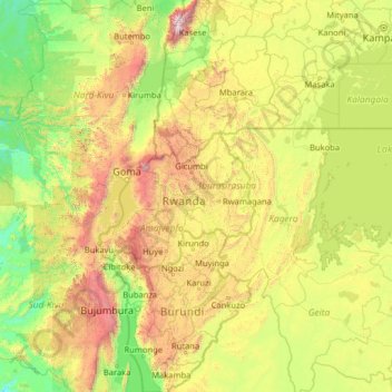
Name: Kigali City topographic map, elevation, terrain.
Location: Kigali City, Rwanda (-4.48596 27.52968 0.71404 32.72968)
Average elevation: 1,298 m
Minimum elevation: 574 m
Maximum elevation: 4,919 m
Other topographic maps
Click on a map to view its topography, its elevation and its terrain.
Bulimba
Rwanda > Northern Province > Muko
Bulimba, Muko, Gicumbi, Northern Province, Rwanda
Average elevation: 1,751 m
Mount Karisimbi
Rwanda > Northern Province > Gataraga
Mount Karisimbi, Gataraga, Musanze, Northern Province, Rwanda
Average elevation: 3,924 m