
Duval County topographic map
Interactive map
Click on the map to display elevation.
About this map
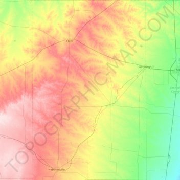
Name: Duval County topographic map, elevation, terrain.
Location: Duval County, Texas, United States of America (27.26252 -98.80337 28.05789 -98.23226)
Average elevation: 144 m
Minimum elevation: 33 m
Maximum elevation: 288 m
Other topographic maps
Click on a map to view its topography, its elevation and its terrain.
Lake Medina Highlands
United States of America > Texas > Lakehills > Lake Medina Highlands
Average elevation: 344 m