
Charlottetown topographic map
Interactive map
Click on the map to display elevation.
About this map
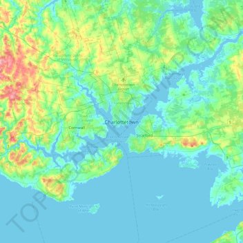
Name: Charlottetown topographic map, elevation, terrain.
Location: Charlottetown, Queens County, Charlottetown, C1A 1R4, Canada (46.07495 -63.29294 46.39495 -62.97294)
Average elevation: 21 m
Minimum elevation: -3 m
Maximum elevation: 121 m