
Bengkulu topographic map
Interactive map
Click on the map to display elevation.
About this map
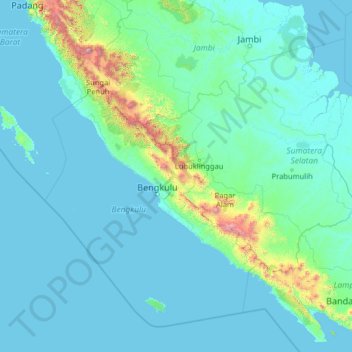
Name: Bengkulu topographic map, elevation, terrain.
Location: Bengkulu, Indonesia (-6.07868 99.97598 -0.95868 105.09598)
Average elevation: 146 m
Minimum elevation: -1 m
Maximum elevation: 3,657 m