
Thank you for supporting this site ❤️
Make a donation
Make a donation
Nuku'alofa topographic map
Click on the map to display elevation.
Thank you for supporting this site ❤️
Make a donation
Make a donation
About this map
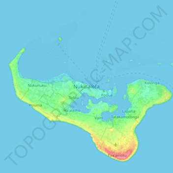
Name: Nuku'alofa topographic map, elevation, terrain.
Location: Nuku'alofa, Vahe Kolofo'ou, Tongatapu, Tonga (-21.29434 -175.36181 -20.97434 -175.04181)
Average elevation: 4 m
Minimum elevation: 0 m
Maximum elevation: 70 m
Thank you for supporting this site ❤️
Make a donation
Make a donation