
Rocky Mountains topographic map
Interactive map
Click on the map to display elevation.
About this map
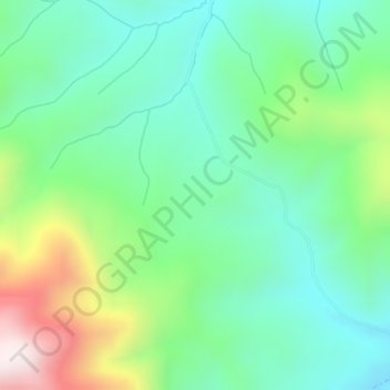
Name: Rocky Mountains topographic map, elevation, terrain.
Location: Rocky Mountains, Teton County, Wyoming, United States (43.35780 -110.91756 43.35790 -110.91746)
Average elevation: 2,292 m
Minimum elevation: 2,090 m
Maximum elevation: 2,769 m
Of the 100 highest peaks with a topographical prominence of at least 500 meters in the Rocky Mountains, 78 (including the 30 highest) are located in Colorado, ten in Wyoming, six in New Mexico, three in Montana, and one in Utah. Public parks and forest lands protect much of the mountain range, and they are popular tourist destinations, especially for hiking, camping, mountaineering, fishing, hunting, mountain biking, snowmobiling, skiing, and snowboarding.