
Richmond County topographic map
Interactive map
Click on the map to display elevation.
About this map
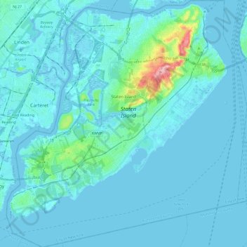
Name: Richmond County topographic map, elevation, terrain.
Location: Richmond County, New York, USA (40.47740 -74.25909 40.65181 -74.03499)
Average elevation: 9 m
Minimum elevation: -5 m
Maximum elevation: 121 m
Other topographic maps
Click on a map to view its topography, its elevation and its terrain.