
Warwick topographic map
Interactive map
Click on the map to display elevation.
Warwick
Warwick has a humid subtropical climate (Köppen Cfa) with hot summers and cool to cold winters. It is slightly cooler and less humid than the proximate southeast Queensland coast due to its inland, elevation location. Frost is present in winter. The climate bears similarities with Richmond, an inland suburb of Sydney, in central New South Wales.
About this map
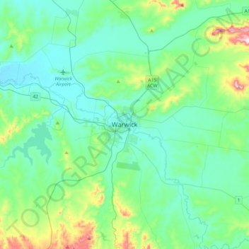
Name: Warwick topographic map, elevation, terrain.
Location: Warwick, Queensland, 4370, Australia (-28.37632 151.87270 -28.05632 152.19270)
Average elevation: 517 m
Minimum elevation: 430 m
Maximum elevation: 903 m