
Prince George topographic map
Interactive map
Click on the map to display elevation.
About this map
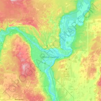
Name: Prince George topographic map, elevation, terrain.
Average elevation: 685 m
Minimum elevation: 555 m
Maximum elevation: 886 m
Other topographic maps
Click on a map to view its topography, its elevation and its terrain.
Salmon Valley
Canada > British Columbia > Regional District of Fraser-Fort George > Area A (Salmon River/Lakes) > Salmon Valley
Salmon Valley, Area A (Salmon River/Lakes), Regional District of Fraser-Fort George, British Columbia, Canada
Average elevation: 649 m
Mount Robson
Canada > British Columbia > Regional District of Fraser-Fort George > Area H (Robson Valley/Canoe)
Mount Robson, Area H (Robson Valley/Canoe), Regional District of Fraser-Fort George, British Columbia, Canada
Average elevation: 3,042 m