
Phetchaburi Province topographic map
Interactive map
Click on the map to display elevation.
About this map
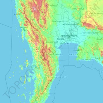
Name: Phetchaburi Province topographic map, elevation, terrain.
Location: Phetchaburi Province, Thailand (10.50929 97.04444 15.62929 102.16444)
Average elevation: 105 m
Minimum elevation: -2 m
Maximum elevation: 1,855 m