
Haut-Katanga topographic map
Interactive map
Click on the map to display elevation.
About this map
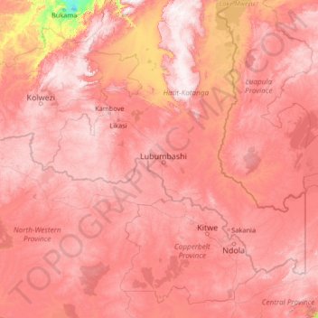
Name: Haut-Katanga topographic map, elevation, terrain.
Location: Haut-Katanga, Democratic Republic of the Congo (-14.16474 24.85319 -9.04474 29.97319)
Average elevation: 1,218 m
Minimum elevation: 570 m
Maximum elevation: 1,783 m