
Kisii topographic map
Interactive map
Click on the map to display elevation.
About this map
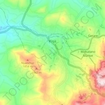
Name: Kisii topographic map, elevation, terrain.
Location: Kisii, 40200, Kenya (-0.69891 34.72965 -0.65375 34.79410)
Average elevation: 1,696 m
Minimum elevation: 1,527 m
Maximum elevation: 1,985 m
Due to the hilly topography and the frequent rains, the town lacks effective drainage systems. The only sewerage formerly in the Daraja Mbili area has been moved to Suneka area.