
Tehachapi topographic map
Interactive map
Click on the map to display elevation.
About this map
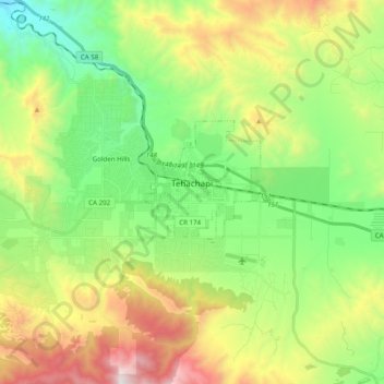
Name: Tehachapi topographic map, elevation, terrain.
Location: Tehachapi, Kern County, California, United States (35.09828 -118.59307 35.15843 -118.39649)
Average elevation: 1,414 m
Minimum elevation: 853 m
Maximum elevation: 2,403 m
Tehachapi /təˈhætʃəpi/ is a city in Kern County, California, in the Tehachapi Mountains, at an elevation of 3,970 feet (1,210 m) between the San Joaquin Valley and the Mojave Desert.