
Seymour topographic map
Interactive map
Click on the map to display elevation.
About this map
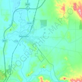
Name: Seymour topographic map, elevation, terrain.
Location: Seymour, Shire of Mitchell, Victoria, 3660, Australia (-37.09163 145.09965 -36.97079 145.22294)
Average elevation: 183 m
Minimum elevation: 129 m
Maximum elevation: 467 m