
Christmas Island topographic map
Interactive map
Click on the map to display elevation.
About this map
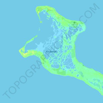
Name: Christmas Island topographic map, elevation, terrain.
Location: Christmas Island, Kiritimati, Kiribati (1.69329 -157.56208 2.04861 -157.16364)
Average elevation: 1 m
Minimum elevation: -3 m
Maximum elevation: 11 m
Other topographic maps
Click on a map to view its topography, its elevation and its terrain.