
Kaikoura topographic map
Interactive map
Click on the map to display elevation.
About this map
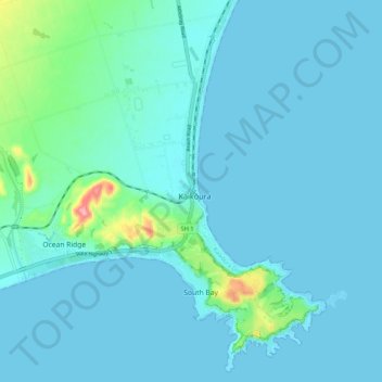
Name: Kaikoura topographic map, elevation, terrain.
Location: Kaikoura, Kaikōura District, Canterbury, 7300, New Zealand (-42.43949 173.64009 -42.35949 173.72009)
Average elevation: 15 m
Minimum elevation: 0 m
Maximum elevation: 138 m
Canterbury trails, hiking, mountain biking, running and outdoor activities