
Ishpeming topographic map
Interactive map
Click on the map to display elevation.
About this map
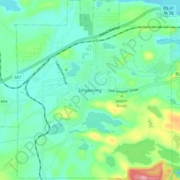
Name: Ishpeming topographic map, elevation, terrain.
Location: Ishpeming, Marquette County, Michigan, 49849, USA (46.46312 -87.69786 46.51389 -87.63382)
Average elevation: 449 m
Minimum elevation: 411 m
Maximum elevation: 569 m