
Te Kauwhata topographic map
Interactive map
Click on the map to display elevation.
About this map
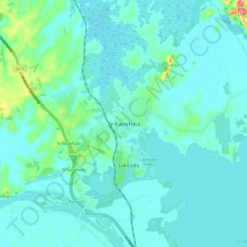
Name: Te Kauwhata topographic map, elevation, terrain.
Location: Te Kauwhata, Waikato District, Waikato, 3710, New Zealand (-37.44346 175.10680 -37.36346 175.18680)
Average elevation: 17 m
Minimum elevation: 1 m
Maximum elevation: 116 m
Waikato District trails, hiking, mountain biking, running and outdoor activities
Other topographic maps
Click on a map to view its topography, its elevation and its terrain.