
Foxton topographic map
Interactive map
Click on the map to display elevation.
About this map
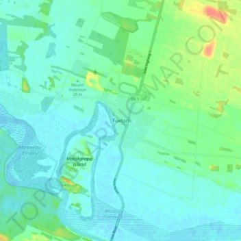
Name: Foxton topographic map, elevation, terrain.
Average elevation: 10 m
Minimum elevation: -3 m
Maximum elevation: 46 m
Other topographic maps
Click on a map to view its topography, its elevation and its terrain.
Levin
New Zealand > Manawatu-Whanganui > Horowhenua District
Levin, Horowhenua District, Manawatū-Whanganui, 5510, New Zealand
Average elevation: 41 m
Foxton Beach
New Zealand > Manawatu-Whanganui > Horowhenua District
Foxton Beach, Horowhenua District, Manawatū-Whanganui, 4815, New Zealand
Average elevation: 4 m
Ohau
New Zealand > Manawatu-Whanganui > Horowhenua District > Ohau
Ohau, Horowhenua District, Manawatu-Whanganui, 5570, New Zealand
Average elevation: 38 m
Lake Horowhenua
New Zealand > Manawatu-Whanganui > Horowhenua District > Levin
Lake Horowhenua, Levin, Horowhenua District, Manawatū-Whanganui, New Zealand
Average elevation: 13 m