
Manapouri topographic map
Interactive map
Click on the map to display elevation.
About this map
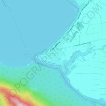
Name: Manapouri topographic map, elevation, terrain.
Average elevation: 213 m
Minimum elevation: 176 m
Maximum elevation: 539 m
Other topographic maps
Click on a map to view its topography, its elevation and its terrain.
The Key
New Zealand > Southland > Southland District > Fiordland Community
The Key, Fiordland Community, Southland District, Southland, 9672, New Zealand
Average elevation: 325 m
Te Anau
New Zealand > Southland > Southland District > Fiordland Community
Te Anau, Fiordland Community, Southland District, Southland, 9600, New Zealand
Average elevation: 249 m
Milford Sound
New Zealand > Southland > Southland District > Fiordland Community
Milford Sound, Fiordland Community, Southland District, Southland, New Zealand
Average elevation: 304 m