
Mosgiel topographic map
Interactive map
Click on the map to display elevation.
About this map
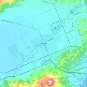
Name: Mosgiel topographic map, elevation, terrain.
Location: Mosgiel, Dunedin City, Otago, 9024, New Zealand (-45.91498 170.30735 -45.83498 170.38735)
Average elevation: 55 m
Minimum elevation: -1 m
Maximum elevation: 464 m
Dunedin City trails, hiking, mountain biking, running and outdoor activities
Other topographic maps
Click on a map to view its topography, its elevation and its terrain.