
Ahipara topographic map
Interactive map
Click on the map to display elevation.
About this map
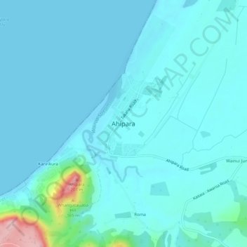
Name: Ahipara topographic map, elevation, terrain.
Location: Ahipara, Far North District, Northland, 0481, New Zealand (-35.18641 173.13621 -35.14641 173.17621)
Average elevation: 22 m
Minimum elevation: -1 m
Maximum elevation: 210 m