
Aurangabad topographic map
Interactive map
Click on the map to display elevation.
About this map
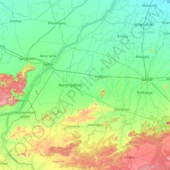
Name: Aurangabad topographic map, elevation, terrain.
Location: Aurangabad, Bihar, India (24.11000 83.86000 25.39000 85.14000)
Average elevation: 166 m
Minimum elevation: 52 m
Maximum elevation: 674 m
Other topographic maps
Click on a map to view its topography, its elevation and its terrain.