
Argomilla topographic map
Interactive map
Click on the map to display elevation.
About this map
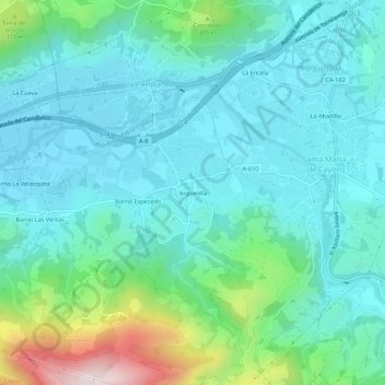
Name: Argomilla topographic map, elevation, terrain.
Location: Argomilla, Valles Pasiegos, Cantabria, 39626, Spain (43.28674 -3.89422 43.32674 -3.85422)
Average elevation: 174 m
Minimum elevation: 64 m
Maximum elevation: 608 m