
Newtown topographic map
Interactive map
Click on the map to display elevation.
About this map
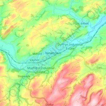
Name: Newtown topographic map, elevation, terrain.
Location: Newtown, Powys, Wales, SY16 1AQ, United Kingdom (52.47358 -3.35437 52.55358 -3.27437)
Average elevation: 207 m
Minimum elevation: 89 m
Maximum elevation: 390 m
Other topographic maps
Click on a map to view its topography, its elevation and its terrain.
Llanwrtyd Wells
United Kingdom > Wales > Powys
Llanwrtyd Wells, Powys, Wales, LD5 4ST, United Kingdom
Average elevation: 296 m
Llan
United Kingdom > Wales > Powys
Llan, Powys, Wales, SY19 7DW, United Kingdom
Average elevation: 232 m
Hay on Wye
United Kingdom > Wales > Powys
Hay on Wye, Powys, Wales, HR3 5AG, United Kingdom
Average elevation: 199 m