
Shatt al-Arab topographic map
Interactive map
Click on the map to display elevation.
About this map
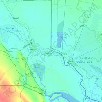
Name: Shatt al-Arab topographic map, elevation, terrain.
Location: Shatt al-Arab, Al-Basra Governorate, 60100, Iraq (29.92931 47.44235 31.00471 48.62352)
Average elevation: 8 m
Minimum elevation: -7 m
Maximum elevation: 139 m
Other topographic maps
Click on a map to view its topography, its elevation and its terrain.
El Furat
Iraq > Al-Basra Governorate > Awjan
El Furat, Awjan, Al-Qurnah Central Sbudsitrict, Al-Qurnah District, Al-Basra Governorate, 601106, Iraq
Average elevation: 4 m