
Holme Valley topographic map
Interactive map
Click on the map to display elevation.
About this map
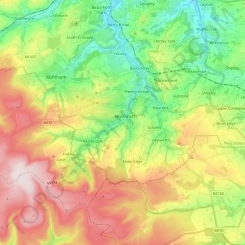
Name: Holme Valley topographic map, elevation, terrain.
Average elevation: 290 m
Minimum elevation: 77 m
Maximum elevation: 581 m
Other topographic maps
Click on a map to view its topography, its elevation and its terrain.
Kirklees
United Kingdom > England > Kirklees
Kirklees, Yorkshire and the Humber, England, United Kingdom
Average elevation: 220 m