
Lake Kaiwai topographic map
Interactive map
Click on the map to display elevation.
About this map
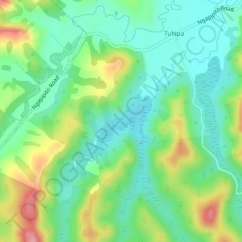
Name: Lake Kaiwai topographic map, elevation, terrain.
Average elevation: 118 m
Minimum elevation: 73 m
Maximum elevation: 210 m
Other topographic maps
Click on a map to view its topography, its elevation and its terrain.
Lake Owhareiti
Lake Owhareiti, Lakeland Lane, Pakaraka, Far North District, Northland, 0472, New Zealand
Average elevation: 123 m