
Lake Te Rangatapu topographic map
Interactive map
Click on the map to display elevation.
About this map
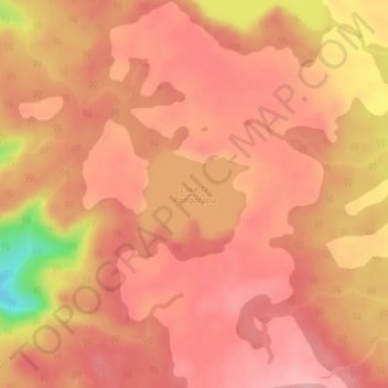
Name: Lake Te Rangatapu topographic map, elevation, terrain.
Location: Lake Te Rangatapu, Chatham Islands, New Zealand (-44.10972 -176.59404 -44.10287 -176.58294)
Average elevation: 260 m
Minimum elevation: 161 m
Maximum elevation: 291 m
Other topographic maps
Click on a map to view its topography, its elevation and its terrain.
Hikurangi Channel
Hikurangi Channel, Chatham Islands, New Zealand
Average elevation: 1 m
Lake Rakeinui
Lake Rakeinui, Chatham Islands, New Zealand
Average elevation: 256 m