
Lud Brook topographic map
Interactive map
Click on the map to display elevation.
About this map
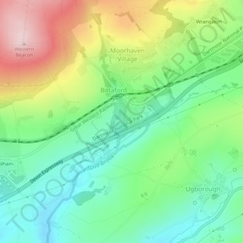
Name: Lud Brook topographic map, elevation, terrain.
Average elevation: 151 m
Minimum elevation: 47 m
Maximum elevation: 331 m
Other topographic maps
Click on a map to view its topography, its elevation and its terrain.
Malborough
United Kingdom > England > South Hams > Malborough
Malborough, South Hams, Devon, South West England, England, United Kingdom
Average elevation: 45 m