
Maui County topographic map
Interactive map
Click on the map to display elevation.
About this map
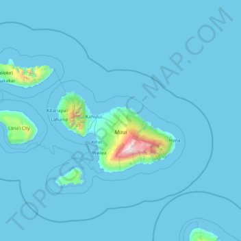
Name: Maui County topographic map, elevation, terrain.
Location: Maui County, Hawaii, United States of America (20.45727 -157.36655 21.27877 -155.92684)
Average elevation: 72 m
Minimum elevation: -1 m
Maximum elevation: 3,030 m
Other topographic maps
Click on a map to view its topography, its elevation and its terrain.
Hawai'i Volcanoes National Park
United States of America > Hawaii > Hilo
Hawai'i Volcanoes National Park, Hilo, Hawaiʻi County, Hawaii, United States of America
Average elevation: 688 m