
Inferno Crater Lake topographic map
Interactive map
Click on the map to display elevation.
About this map
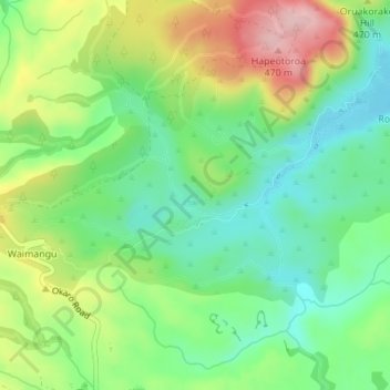
Name: Inferno Crater Lake topographic map, elevation, terrain.
Average elevation: 421 m
Minimum elevation: 337 m
Maximum elevation: 562 m
Other topographic maps
Click on a map to view its topography, its elevation and its terrain.
Southern Crater Lake
New Zealand > Bay of Plenty > Waimangu
Southern Crater Lake, Waimangu Bus Route, Waimangu, Rotorua District, Bay of Plenty, New Zealand
Average elevation: 429 m