
Baranof Island topographic map
Interactive map
Click on the map to display elevation.
About this map
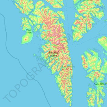
Name: Baranof Island topographic map, elevation, terrain.
Location: Baranof Island, Sitka, Alaska, USA (56.16128 -135.69305 57.56344 -134.61592)
Average elevation: 116 m
Minimum elevation: -5 m
Maximum elevation: 1,529 m
Other topographic maps
Click on a map to view its topography, its elevation and its terrain.