
New Orleans topographic map
Interactive map
Click on the map to display elevation.
About this map
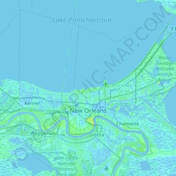
Name: New Orleans topographic map, elevation, terrain.
Location: New Orleans, Orleans Parish, Louisiana, United States (29.86548 -90.13993 30.19947 -89.62518)
Average elevation: 1 m
Minimum elevation: -6 m
Maximum elevation: 30 m
New Orleans is world-renowned for its distinct music, Creole cuisine, unique dialect, and its annual celebrations and festivals, most notably Mardi Gras. The historic heart of the city is the French Quarter, known for its French and Spanish Creole architecture and vibrant nightlife along Bourbon Street. The city has been described as the "most unique" in the United States, owing in large part to its cross-cultural and multilingual heritage. Founded in 1718 by French colonists, New Orleans was once the territorial capital of French Louisiana before being traded to the United States in the Louisiana Purchase of 1803. New Orleans in 1840 was the third-most populous city in the United States, and it was the largest city in the American South from the Antebellum era until after World War II. The city's location and flat elevation have historically made it very vulnerable to flooding. State and federal authorities have installed a complex system of levees and drainage pumps in an effort to protect the city.