
Ogooué-Ivindo topographic map
Interactive map
Click on the map to display elevation.
About this map
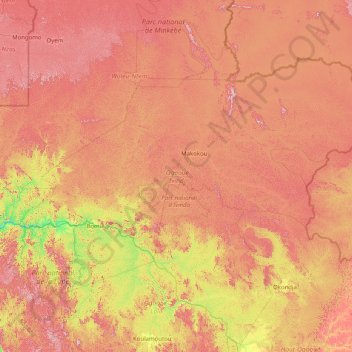
Name: Ogooué-Ivindo topographic map, elevation, terrain.
Location: Ogooué-Ivindo, Gabon (-0.73169 11.27167 1.43775 14.49611)
Average elevation: 477 m
Minimum elevation: 85 m
Maximum elevation: 990 m
Other topographic maps
Click on a map to view its topography, its elevation and its terrain.
Olonga
Gabon > Haut-Ogooué Province > Olonga
Olonga, Haut-Ogooué Province, Gabon
Average elevation: 322 m
Libreville
Gabon > Estuaire > Libreville
Libreville, Libreville Department, Estuaire, 2221, Gabon
Average elevation: 6 m