
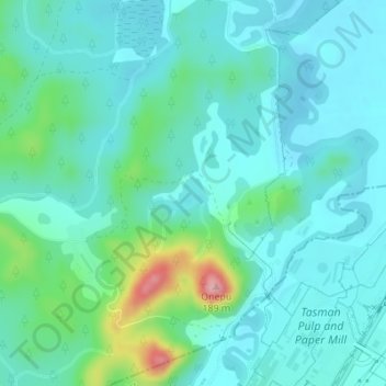
Lake Rotoitipaku topographic map
Interactive map
Click on the map to display elevation.
About this map
Name: Lake Rotoitipaku topographic map, elevation, terrain.
Average elevation: 45 m
Minimum elevation: 14 m
Maximum elevation: 176 m
Other topographic maps
Click on a map to view its topography, its elevation and its terrain.
Kawerau
New Zealand > Bay of Plenty > Kawerau
Kawerau, Kawerau District, Bay of Plenty, 3127, New Zealand
Average elevation: 107 m
Lake Pupuwharau
New Zealand > Bay of Plenty > Kawerau
Lake Pupuwharau, East Bank Road, Kawerau, Kawerau District, Bay of Plenty, 3127, New Zealand
Average elevation: 67 m