
Lyndhurst topographic map
Interactive map
Click on the map to display elevation.
About this map
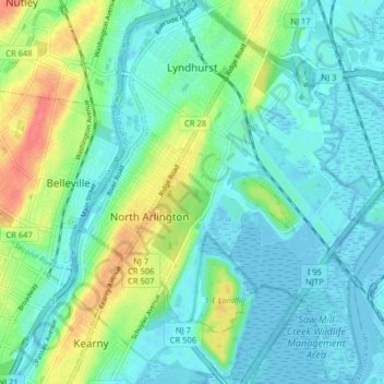
Name: Lyndhurst topographic map, elevation, terrain.
Location: Lyndhurst, Bergen County, New Jersey, USA (40.76211 -74.13999 40.82263 -74.08335)
Average elevation: 15 m
Minimum elevation: -3 m
Maximum elevation: 57 m