
Rock Pillar topographic map
Interactive map
Click on the map to display elevation.
About this map
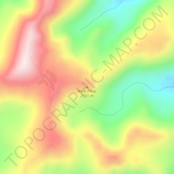
Name: Rock Pillar topographic map, elevation, terrain.
Location: Rock Pillar, Idaho County, Idaho, USA (45.99598 -115.06711 45.99608 -115.06701)
Average elevation: 2,054 m
Minimum elevation: 1,807 m
Maximum elevation: 2,294 m
Other topographic maps
Click on a map to view its topography, its elevation and its terrain.
American Falls
USA > Idaho > American Falls
American Falls, Power County, Idaho, 83211, USA
Average elevation: 1,345 m
Memory Ranch Rock
Memory Ranch Rock, West Memorial Way, Kuna, Ada County, Idaho, USA
Average elevation: 810 m