
Hikuwai River topographic map
Interactive map
Click on the map to display elevation.
About this map
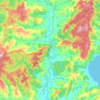
Name: Hikuwai River topographic map, elevation, terrain.
Location: Hikuwai River, Gisborne, New Zealand (-38.27004 178.24520 -38.15753 178.26437)
Average elevation: 192 m
Minimum elevation: 0 m
Maximum elevation: 531 m
Other topographic maps
Click on a map to view its topography, its elevation and its terrain.
Lake Karangata
Lake Karangata, Berry Road, Gisborne, New Zealand
Average elevation: 270 m
Pourewa Island
Pourewa Island, Gisborne, 4046, New Zealand
Average elevation: 108 m
Waiomoko River
Waiomoko River, Gisborne, 4073, New Zealand
Average elevation: 34 m
Mangaheia River
Mangaheia River, Gisborne, 4046, New Zealand
Average elevation: 14 m
Waipaoa River
Waipaoa River, Gisborne, 4071, New Zealand
Average elevation: 178 m