
Kings County topographic map
Interactive map
Click on the map to display elevation.
About this map
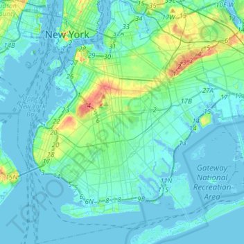
Name: Kings County topographic map, elevation, terrain.
Location: Kings County, New York, USA (40.54985 -74.05585 40.73940 -73.83356)
Average elevation: 9 m
Minimum elevation: -8 m
Maximum elevation: 61 m
Other topographic maps
Click on a map to view its topography, its elevation and its terrain.