
Lake Rotomā topographic map
Interactive map
Click on the map to display elevation.
About this map
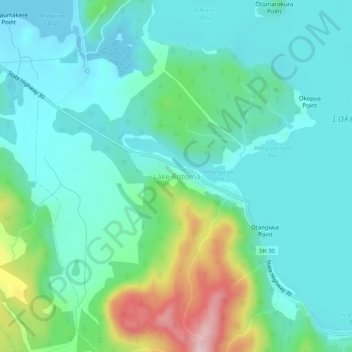
Name: Lake Rotomā topographic map, elevation, terrain.
Location: Lake Rotomā, Bay of Plenty, New Zealand (-38.07051 176.54247 -38.03051 176.58247)
Average elevation: 362 m
Minimum elevation: 297 m
Maximum elevation: 583 m
Other topographic maps
Click on a map to view its topography, its elevation and its terrain.
Whakarewarewa Lagoon
New Zealand > Bay of Plenty > Lake Rotomā
Whakarewarewa Lagoon, Manawahe Road, Lake Rotomā, Rotorua District, Bay of Plenty, New Zealand
Average elevation: 335 m