
Morse topographic map
Interactive map
Click on the map to display elevation.
About this map
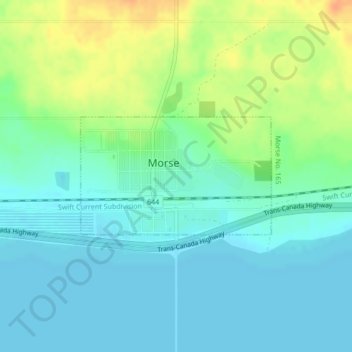
Name: Morse topographic map, elevation, terrain.
Location: Morse, Saskatchewan, S0H 3C0, Canada (50.41013 -107.04744 50.41919 -107.02446)
Average elevation: 702 m
Minimum elevation: 690 m
Maximum elevation: 728 m
Other topographic maps
Click on a map to view its topography, its elevation and its terrain.
Saskatoon
Canada > Saskatchewan > Saskatoon
Saskatoon lies on a long belt of rich, potassic chernozem in middle-southern Saskatchewan and is found in the aspen parkland biome. The lack of surrounding mountainous topography gives the city a relatively flat grid, though the city does sprawl over a few hills and into a few valleys. The lowest point in the…
Average elevation: 510 m