
Cle Elum topographic map
Interactive map
Click on the map to display elevation.
About this map
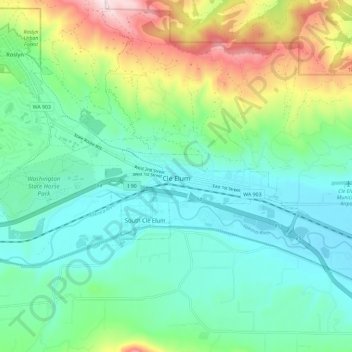
Name: Cle Elum topographic map, elevation, terrain.
Average elevation: 697 m
Minimum elevation: 561 m
Maximum elevation: 1,058 m
Cle Elum has a humid continental climate, Köppen subtype Dsb. The elevation is 1909 feet and temperatures are cooler than areas to the west. The coldest month is December, a trait common in the Pacific Northwest. But hot temperatures still occur, and not just in summer: on March 18, 1968, the temperature soared to 95 °F.