
Otama topographic map
Interactive map
Click on the map to display elevation.
About this map
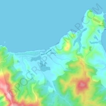
Name: Otama topographic map, elevation, terrain.
Location: Otama, Thames Coromandel District, Waikato, New Zealand (-36.72852 175.74567 -36.68852 175.78567)
Average elevation: 42 m
Minimum elevation: 0 m
Maximum elevation: 223 m
Waikato trails, hiking, mountain biking, running and outdoor activities