
Wawa Dam topographic map
Interactive map
Click on the map to display elevation.
About this map
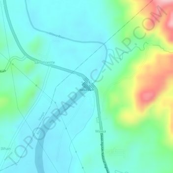
Name: Wawa Dam topographic map, elevation, terrain.
Location: Wawa Dam, Wawa, Bayugan, Agusan del Sur, Caraga, Philippines (8.80308 125.70693 8.80443 125.70824)
Average elevation: 78 m
Minimum elevation: 29 m
Maximum elevation: 224 m