
Goulburn topographic map
Interactive map
Click on the map to display elevation.
Goulburn
Owing to its elevation, Goulburn has an Oceanic climate (Cfb) with warm summers and cool winters, and a high diurnal temperature variation. Its climate is variable, though generally dry with maximum temperatures averaging from 11.8 °C (53.2 °F) in July to 28.3 °C (82.9 °F) in January. Rainfall is distributed evenly throughout the year, with an annual average of 542.8 mm (21.4 in). Snow occasionally falls, although rarely in significant quantities due to the slight foehn effect produced by the ranges to the west of Goulburn—namely, those straddling Crookwell. Temperature extremes have ranged from −10.9 to 42.8 °C (12.4 to 109.0 °F).
About this map
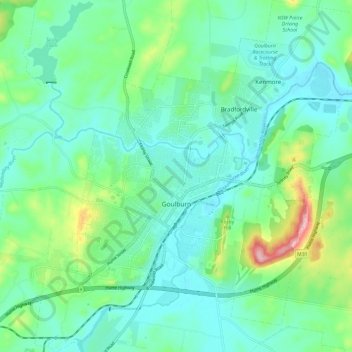
Name: Goulburn topographic map, elevation, terrain.
Average elevation: 666 m
Minimum elevation: 620 m
Maximum elevation: 819 m