
Coalgate topographic map
Interactive map
Click on the map to display elevation.
About this map
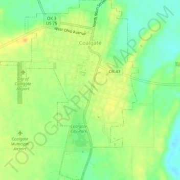
Name: Coalgate topographic map, elevation, terrain.
Location: Coalgate, Coal County, Oklahoma, 74538, United States (34.51493 -96.23707 34.54535 -96.20876)
Average elevation: 186 m
Minimum elevation: 170 m
Maximum elevation: 199 m